Desktop: Scroll to zoom. Left mouse button to rotate, right button to drag model in frame. Mobile: Pinch to zoom, swipe to rotate
Terrain Visualisations
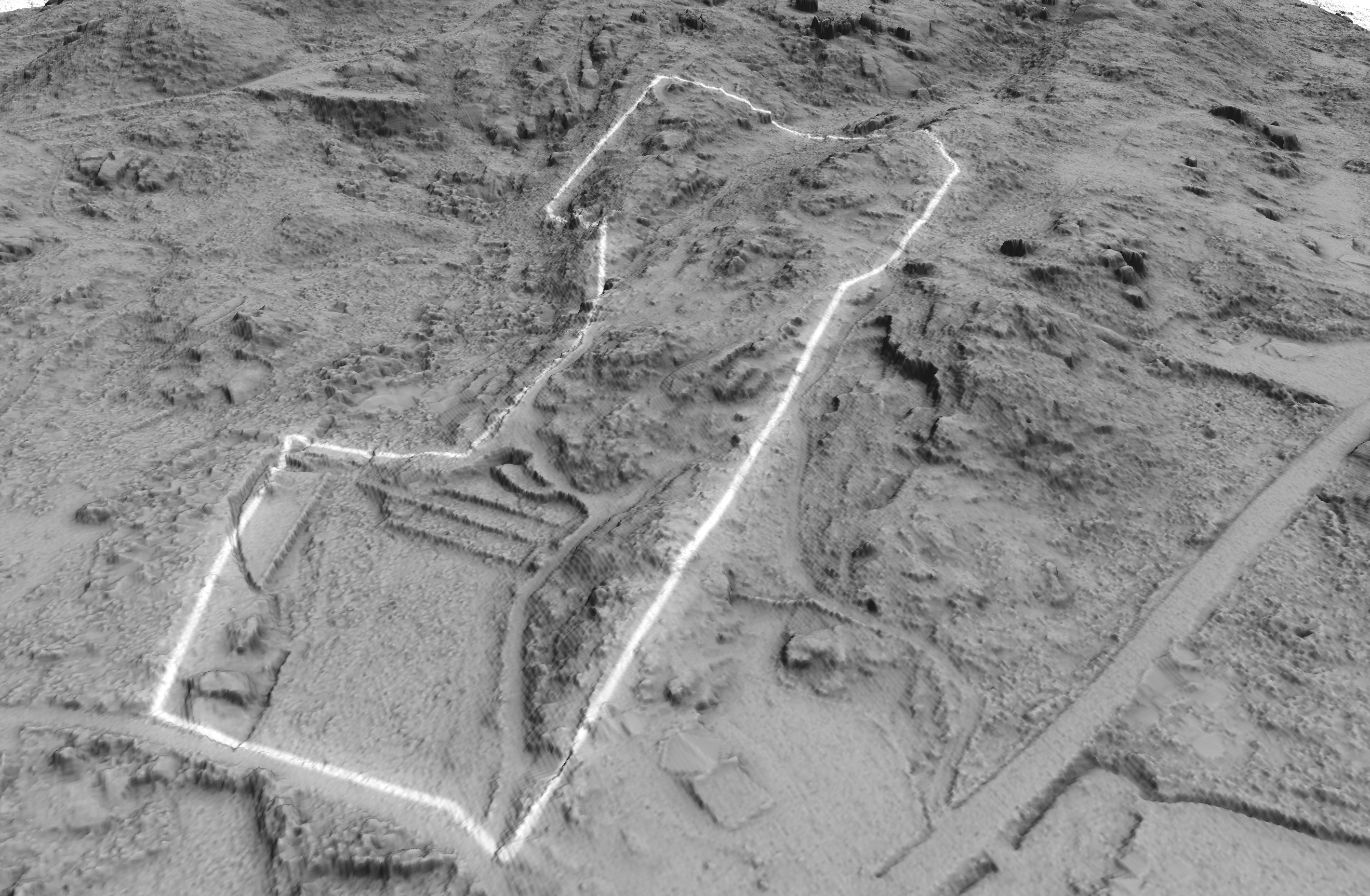
3D Terrain Model
This model brings the landscape to life. It reveals the true shape of the land — not just as lines on a map, but as a physical form you can read instantly. Slopes, ridges, valleys and subtle undulations become obvious, making it far easier to understand how the land actually behaves. This is where patterns start to make sense. Water flow, exposure, access routes and build potential can all be visualised in context, rather than guessed from flat maps. For property buyers, it removes uncertainty. For landowners and planners, it provides a clear foundation for decision-making.
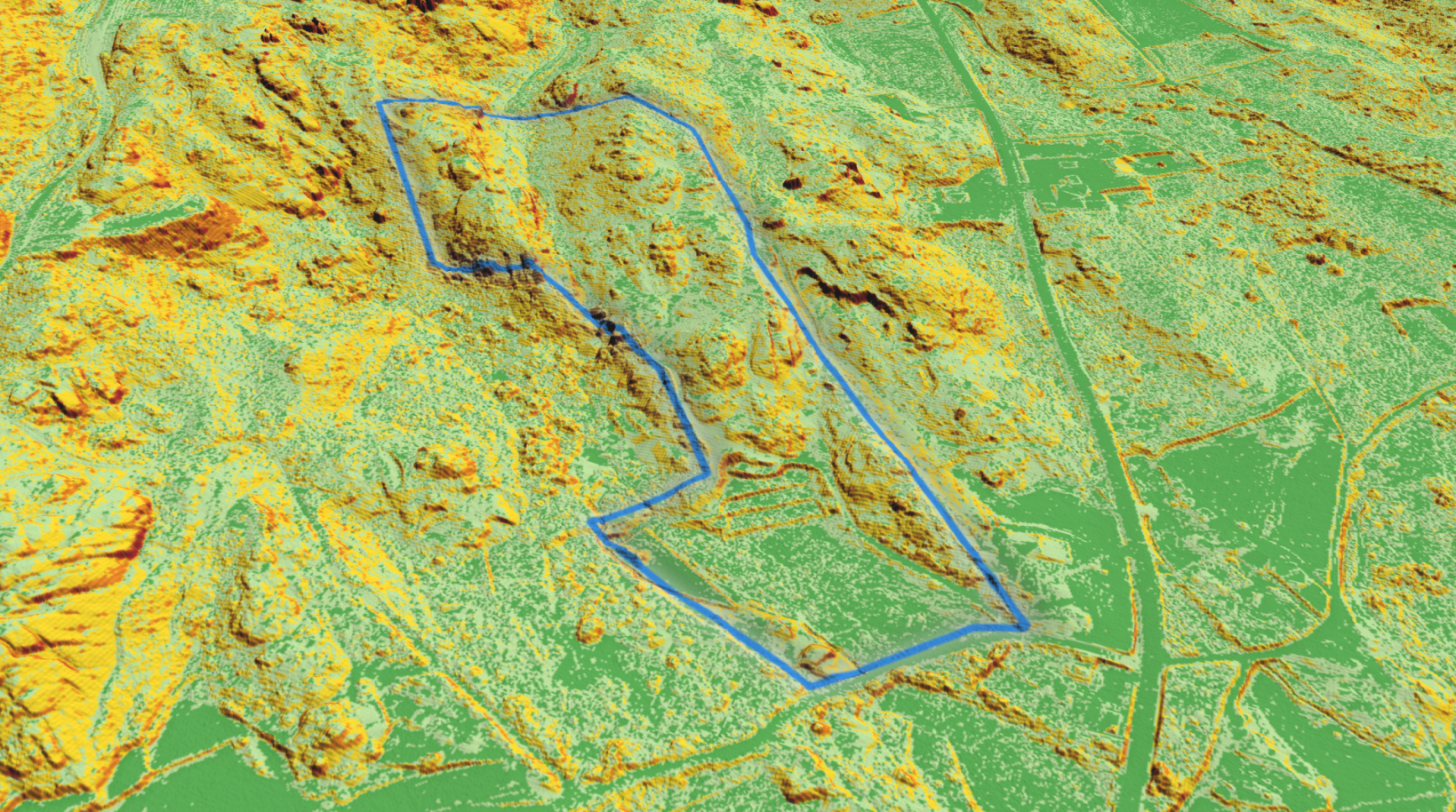
3D Slope overlay
Understand how the land has been shaped — both naturally and by design.
This model reveals the true steepness of the terrain, clearly distinguishing usable ground from constrained areas.
It provides immediate insight into where development, access or cultivation is realistically viable. On this site, historic terracing has been introduced to overcome slope limitations — transforming steep gradients into productive land.
The model highlights both the original constraints and the logic behind these interventions.
It’s a clear example of how terrain dictates land use — and how intelligent design can work with it.
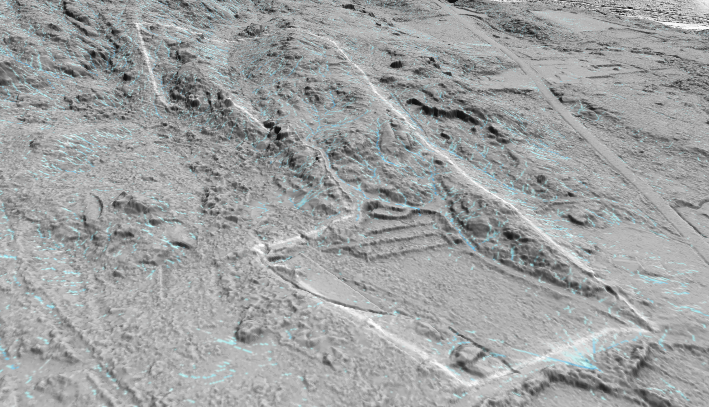
3D Flow Analysis
Understand where water can be managed — not just where it flows.
This model exposes the underlying drainage structure of the land, showing where water accelerates, concentrates and exits the site.
In three dimensions, key intervention points become obvious.
These are leverage points.
Targeted interventions at these locations can slow flow, spread water, and increase infiltration — reducing erosion while building soil and recharging groundwater.
It’s a shift from reactive to deliberate land management.
Rather than dealing with the consequences of runoff, this approach identifies where small, well-placed changes can deliver long-term gains.