Land Intelligence
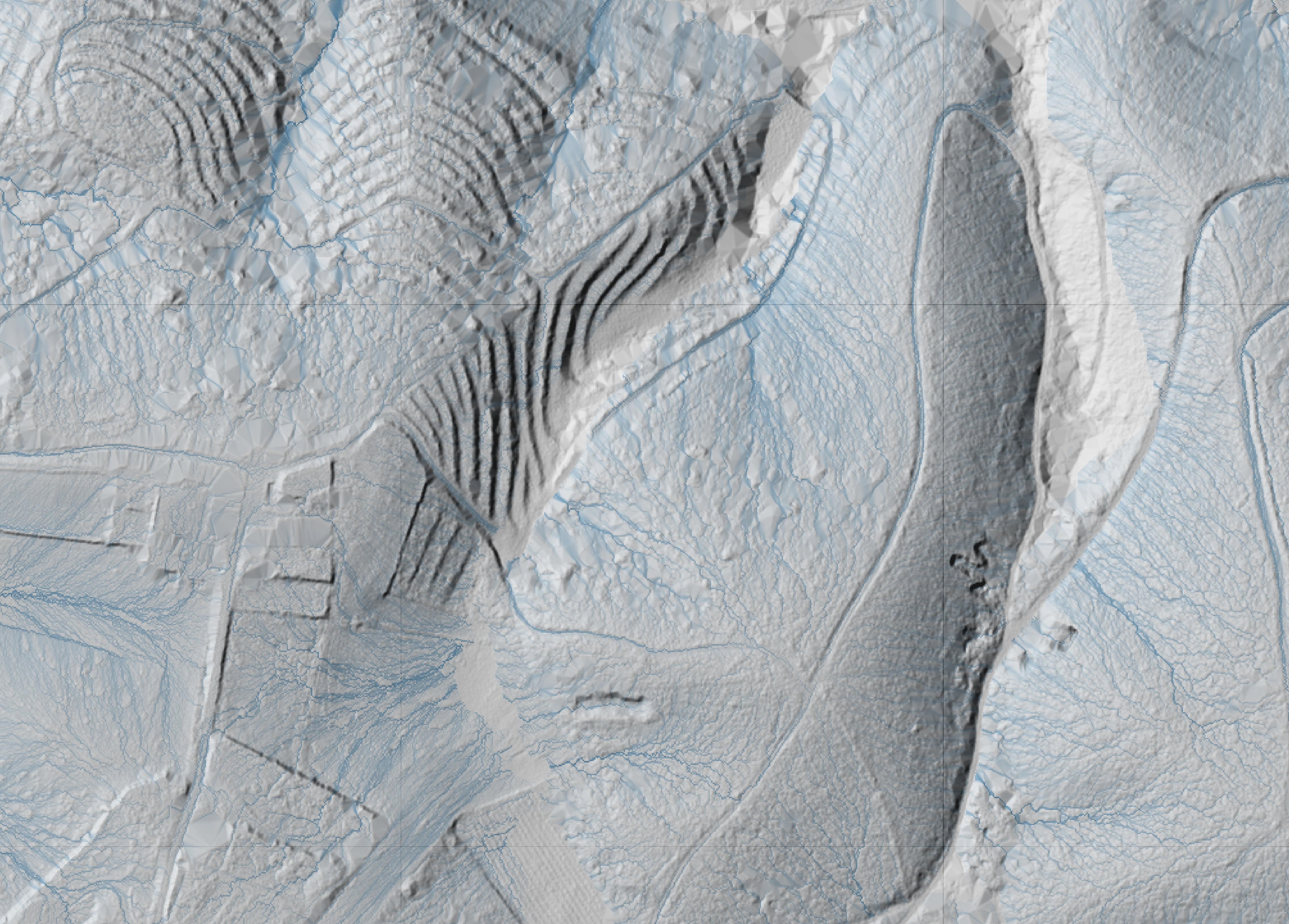
Flow Accumulation
Flow accumulation mapping shows how water moves across the land after rainfall, revealing natural drainage lines and areas where runoff concentrates. It highlights wetter zones, potential erosion pressure and better drained ground.
This helps you to understand how the land actually behaves, supporting decisions around access, planting, drainage, where to retain water, where to redirect it and future placement of buildings, driveways etc.
This helps you to understand how the land actually behaves, supporting decisions around access, planting, drainage, where to retain water, where to redirect it and future placement of buildings, driveways etc.