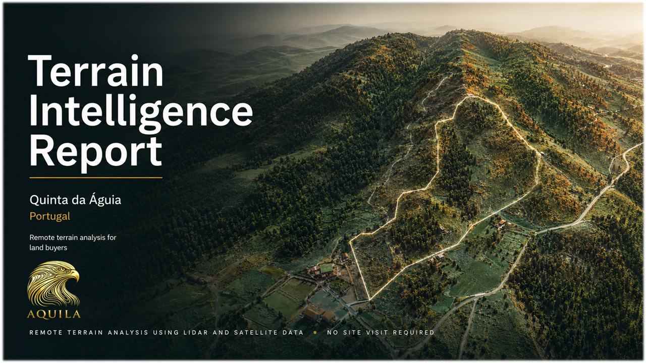
Land Intelligence
Property reports
Free Sample Report
See exactly how Aquila Property Reports help reveal terrain, water flow, slope, solar exposure and wildfire context before you buy land.
Download a complete sample report and explore the level of analysis included.
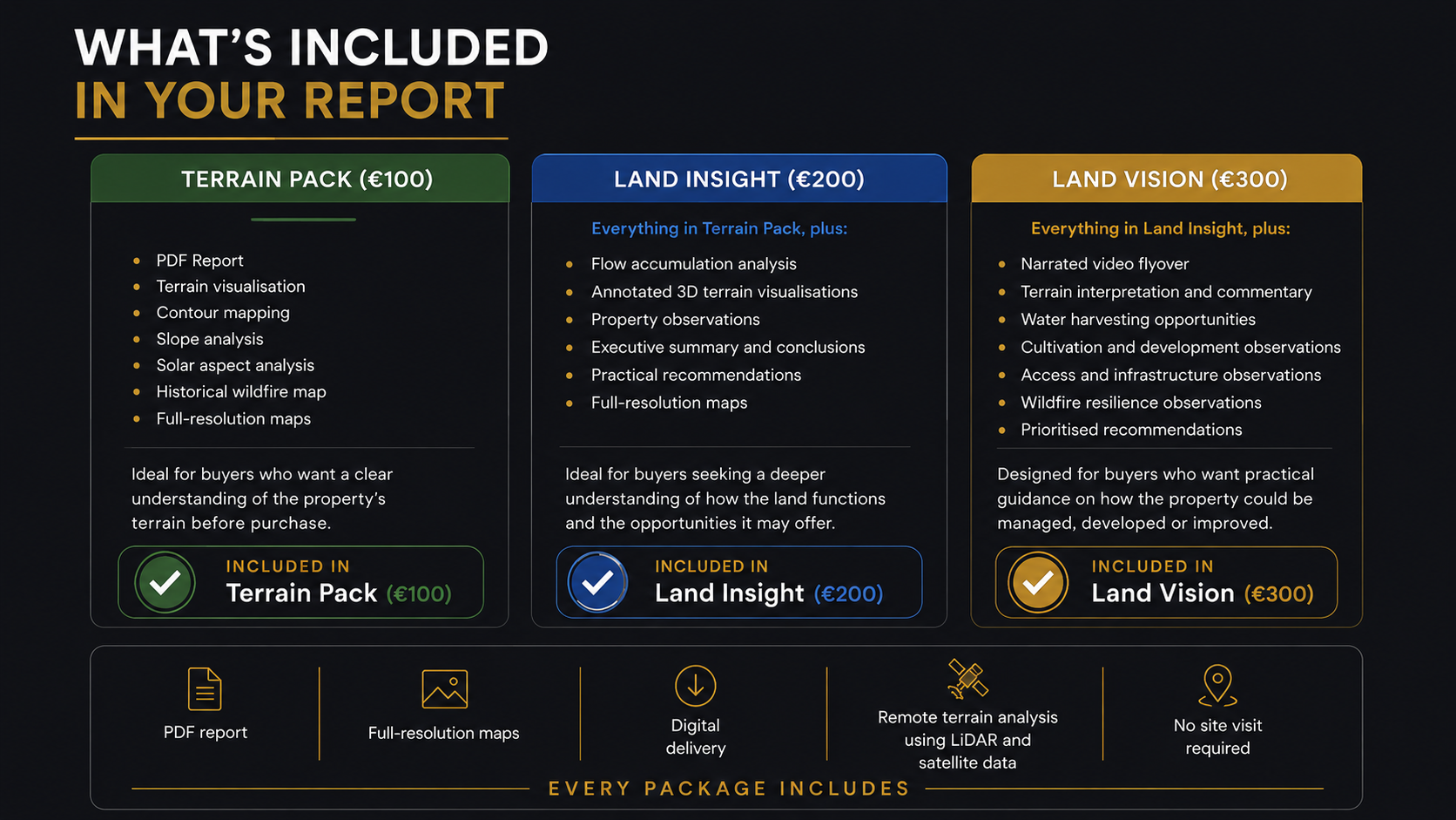
Sample report is optimised for web download. Client reports include full (300dpi) imagery.