
Land Intelligence
Terrain
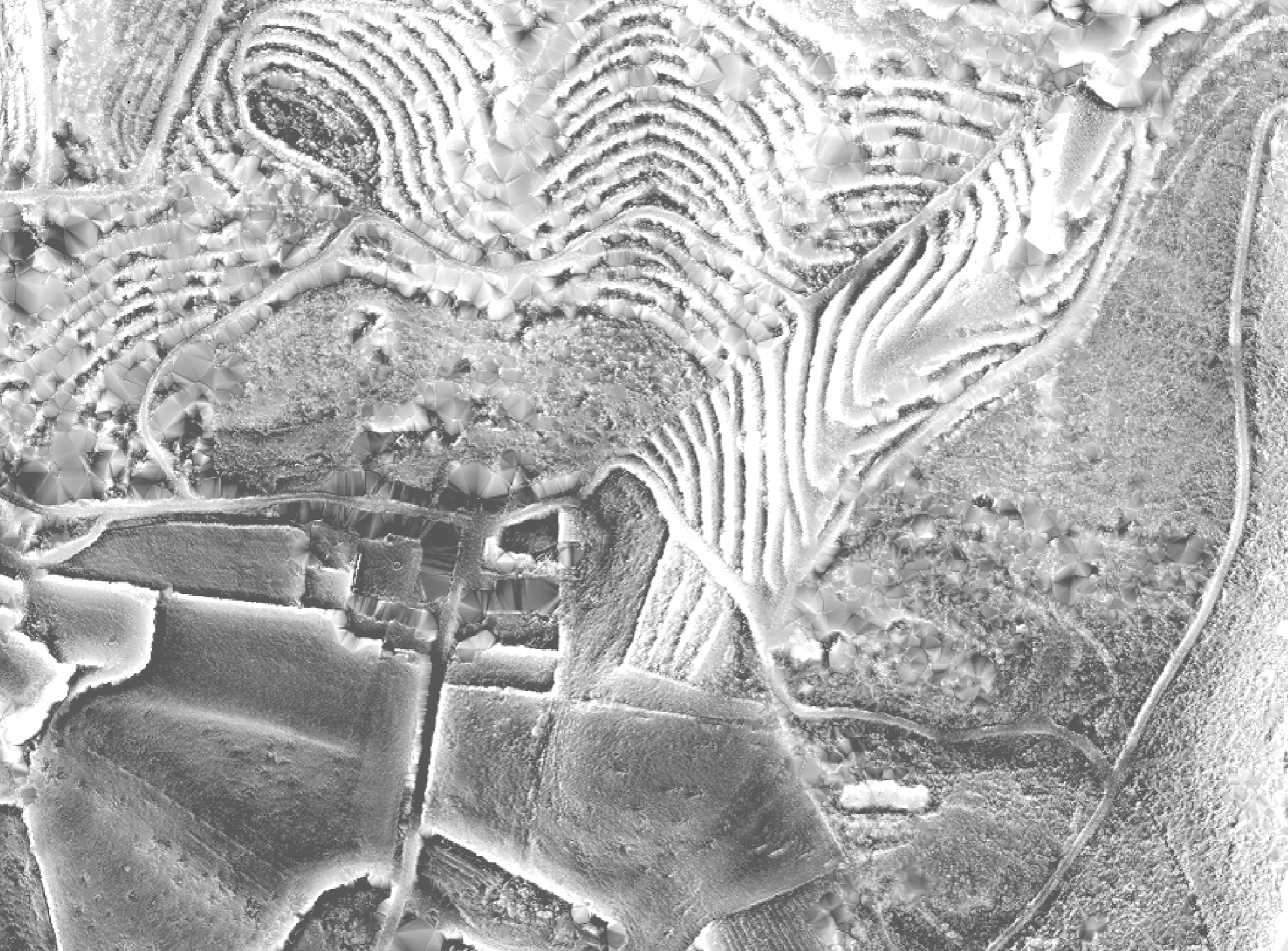
Understand slope,shape and terrain at a glance
A simple hillshade model provides a clear, immediate sense of slope and form.
For a more detailed analysis we apply Relief Visualisation Toolbox (RVT), a method used by scientists and archaeologists to reveal subtle features such as terraces, walls and historic structures.
Available as interactive 3D models.
Boundary Interpretation
Where boundary data is provided by the customer, it is refined and aligned with visible terrain features where possible. Natural features such as walls, tracks, terraces and changes in slope are used to improve visual accuracy and context
Boundaries shown are indicative only and do not constitute legal property boundaries. For legal verification, consult official land registry documents or a qualified surveyor.