Land Intelligence
Contour Maps
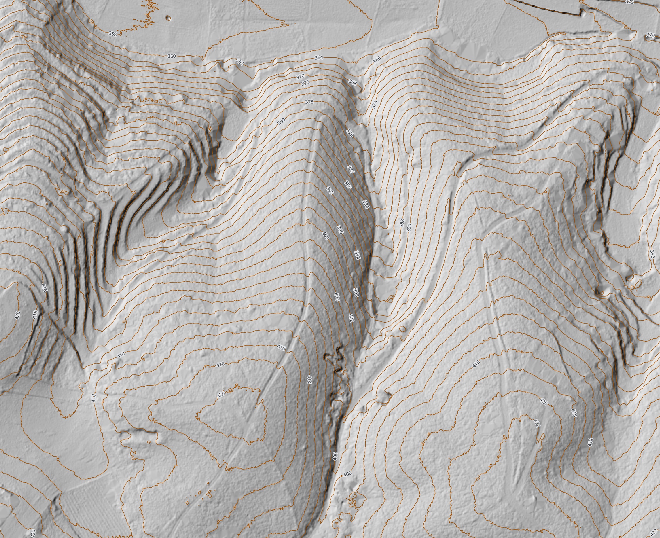
Contour maps show the shape of the land using lines of equal elevation, making it easier to understand slope, landform and changes in levels across a property.
This makes contour mapping useful for understanding how usable a site really is. It can support decisions around access, building placement, track design and identifying flatter ground suited to cultivation or other practical uses.
Contours also form the basis for working with the land rather than against it. Planting along a contour can help prevent runoff and surface water movement thereby reducing erosion, while features such as swales can be positioned effectively to slow, spread and sink water into the landscape.