
Land Intelligence
Wildfire Resilience
View and Download the free guide below.
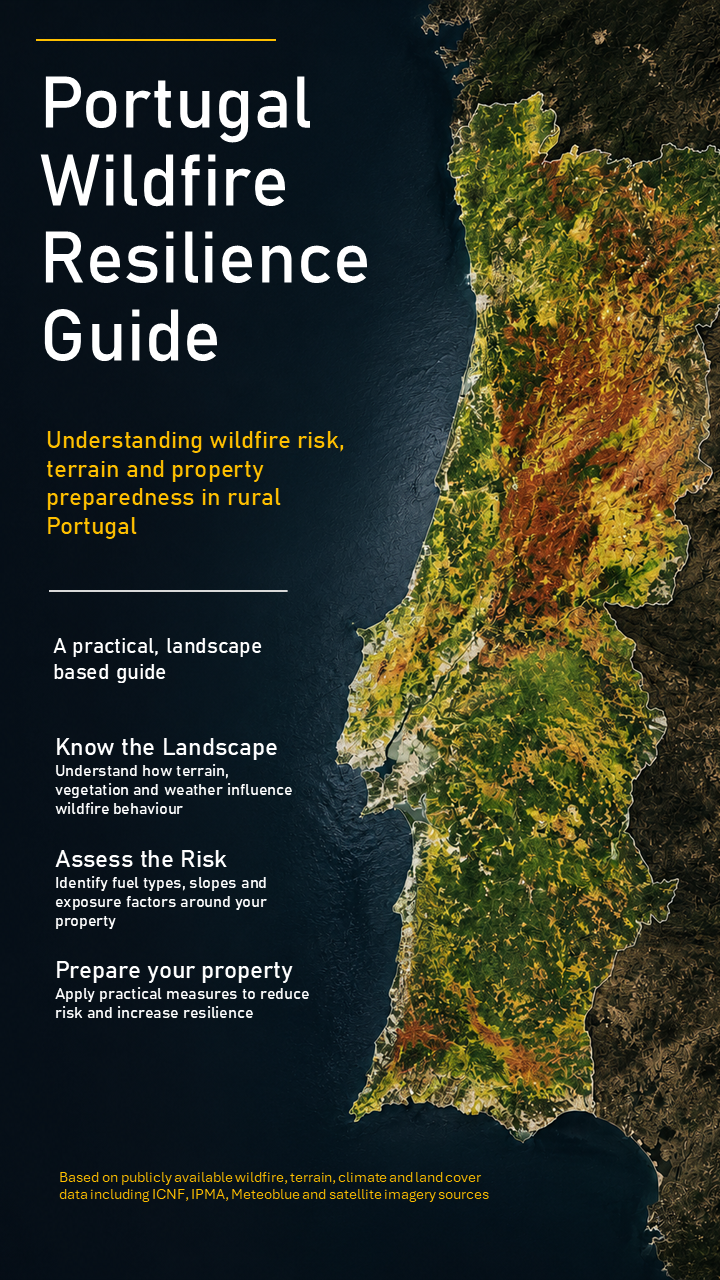
Building a More Complete Picture
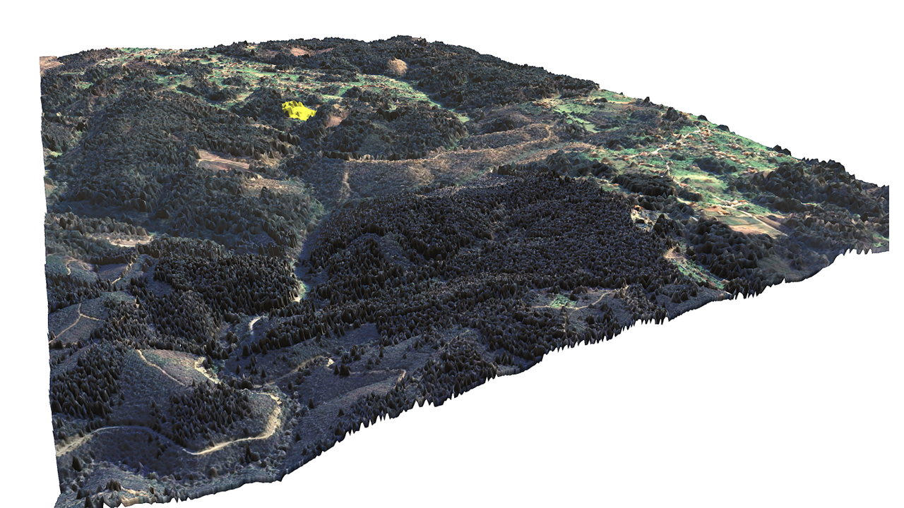
Satellite imagery draped over a LiDAR-derived surface model reveals the structure of the landscape, including vegetation height, terrain and visible evidence of past wildfire impacts. Areas affected by the 2017 wildfire remain clearly visible years later, demonstrating how fire can leave a lasting imprint on the landscape.
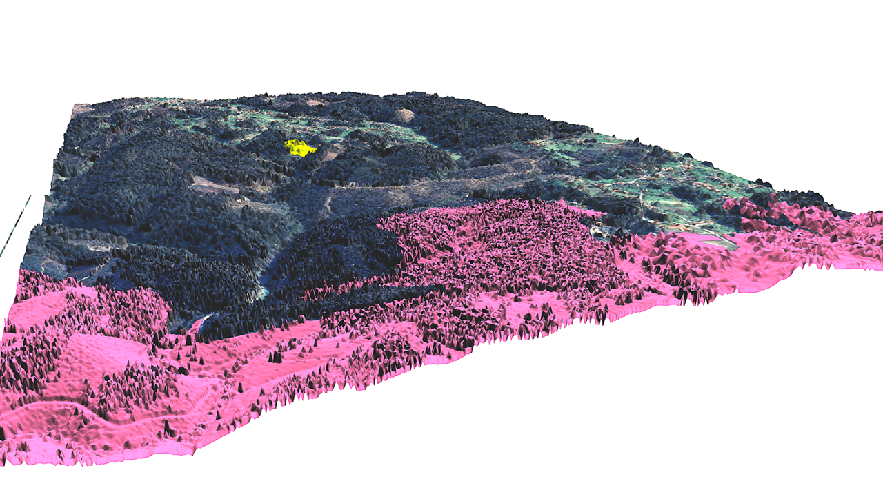
The pink overlay shows the area affected by the 2017 wildfire. Viewed against the LiDAR-derived surface model the scale of the event and its relationship to the surrounding landscape becomes easier to undertand
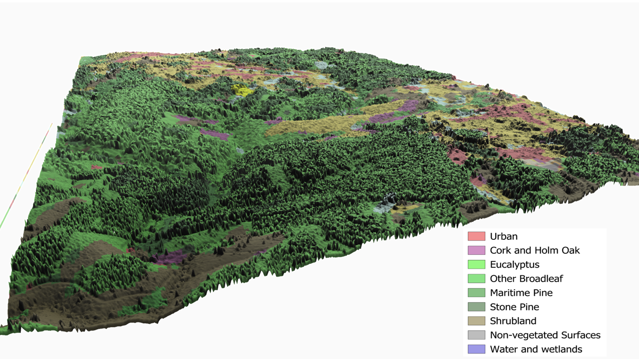
Combining land-cover classification with LiDAR-derived vegetation height creates a more realistic view of the landscape. Different vegetation types can be seen in their true spatial context, helping identify fuel continuiy, forest structure and potential wildfire pathways that may ot be obvious from a conventional map.
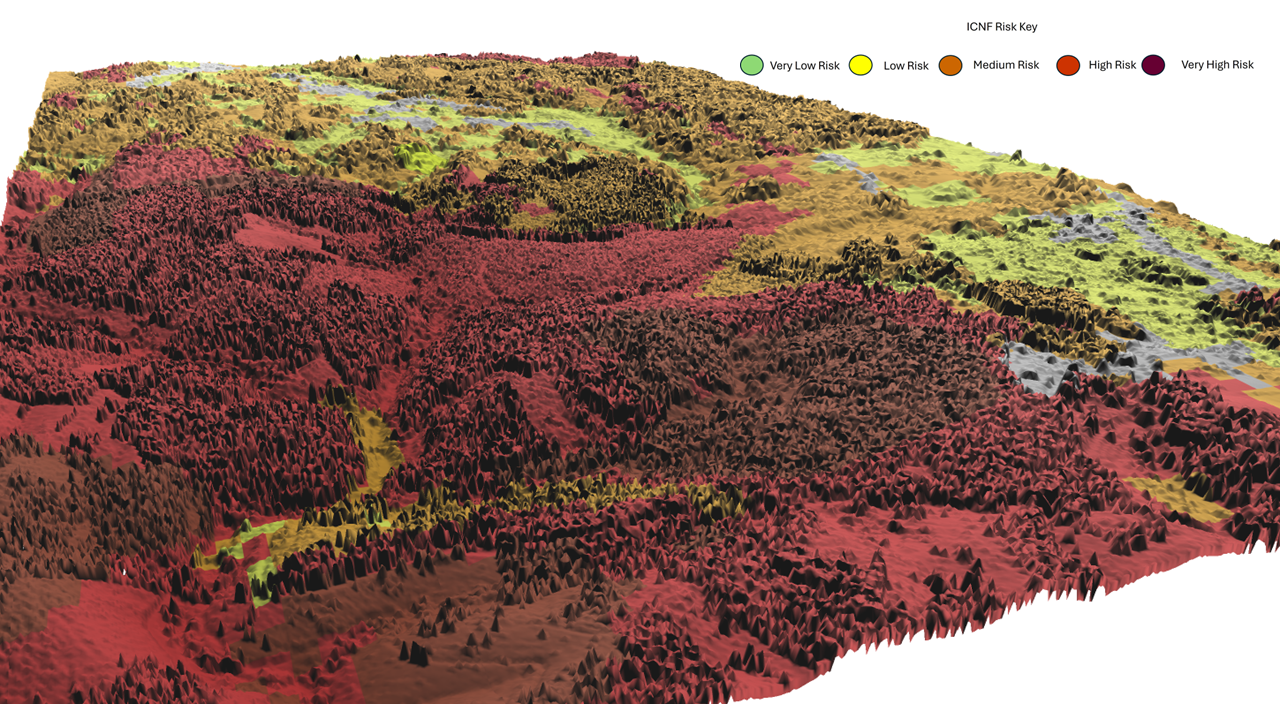
The official ICNF (Instituto da Conservação da Natureza e das Florestas) wildfire risk map can be viewed in three dimensions by draping it over a LiDAR-derived surface model. This makes it easier to understand how mapped risk relates to valleys, ridges, vegetation patterns and the wider landscape. In this example, lower risk areas are concentrated within sheltered valley-bottoms, while higher risk zones correspond closely with extensive forested slopes and continuous vegetation cover.
Understanding your landscape is the first step towards making informed land management decisions. Through terrain analysis, wildfire mapping, historical fire data, land-use interpretation, and 3D visualisation, Aquila Land Intelligence helps landowners gain a clearer picture of the opportunities and challenges surrounding their property. For enquiries, property assessments, or bespoke analysis, get in contact.